Adventure 5 - Te Araroa
with Robbie
Puhoi River and top of the dome to Te Arai
December’s adventure was about completing another couple of sections of the Te Araroa trail, but more importantly, doing parts of it with the kids. With school holidays on, Patrick and Robbie were free to come along, which shaped the trip plan. It became about seeing what was realistic with them involved.
Puhoi River Kayak
We started gently, with the Puhoi River section of the trail. Jo, Patrick and Robbie all joined me for the morning. Jo and Robbie had their own kayaks, while Patrick (Sporting a broken arm from rolling a go cart earlier in the month) shared a double kayak with me.
We launched from Puhoi around 9:30am and drifted downriver with the tide. It was busy, plenty of other families out, but relaxed. A good start to the adventure and a fun way to spend the morning with the family.
We finished at Wenderholm Regional Park, I’d walked through here on the previous adventure and have now completed the trail from Pohoi to Takapuna.
The others waited at Wenderholm while I was shuttled back to the car, and returned to Wenderholm for a picnic lunch before the hard part of the day kicked off.
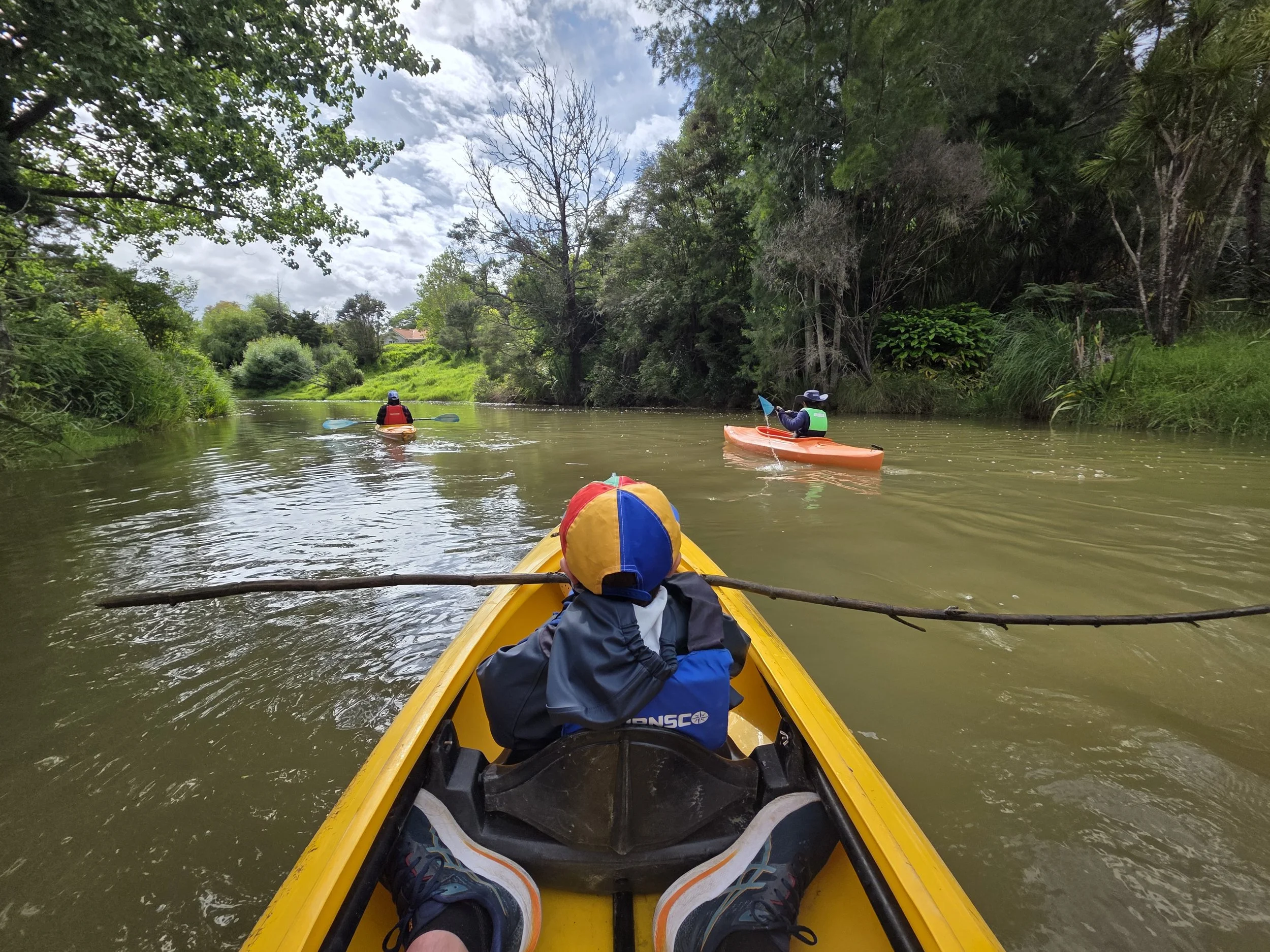
Pohui River kayak with the family
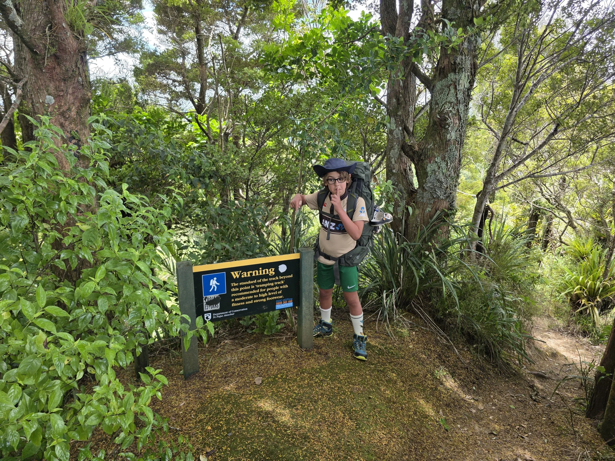
Fair warning of what we were getting into
Heading for the Dome
The afternoon was where things got more serious. Jo and Patrick dropped Robbie and I off at the top of the Dome on SH1 and from there we set off East towards Pakiri.
We didn’t have a fixed endpoint. The optimistic goal was a private campsite in the hills above Pakiri (about 22 km away) but that was more of a “see how we go” plan than a firm target.
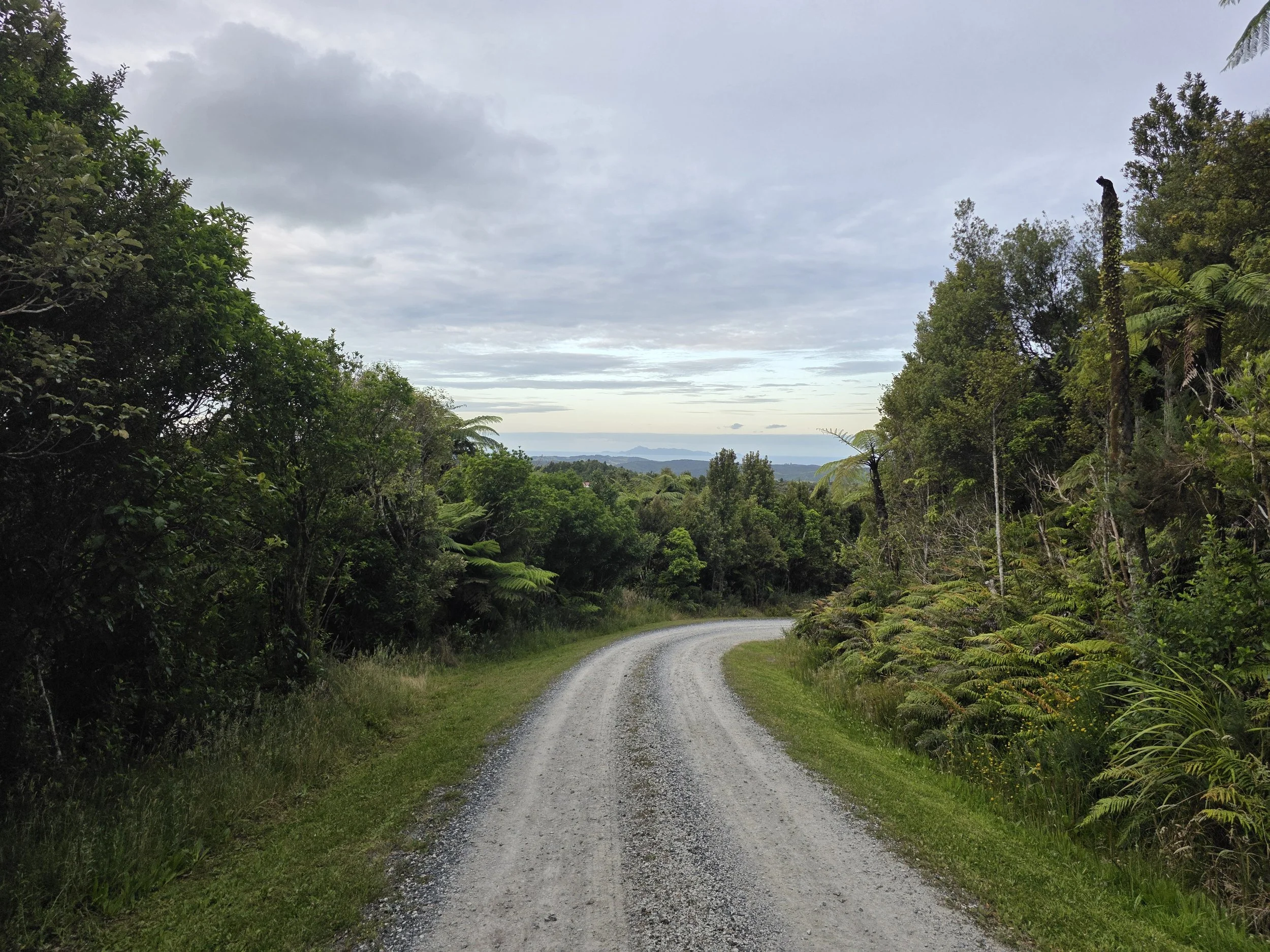
The climb started immediately on a nicely maintained track. After about half an hour we reached the Dome lookout, with views back across the valley towards Warkworth. A sign there made it clear the easy stuff was over, warning that the track ahead was proper tramping. Fair warning!!!
The trail followed the ridgeline. Constant climbing and descending, very little flat. We scrambled over rocky outcrops, picked our way through roots, and moved steadily but slowly. The highlight was a beautiful section of kauri forest, complete with boardwalks to protect the trees. We stopped for a break amongst the huge trees, a very cool spot.
About three hours from the start we left native bush and entered a private pine plantation, dropping down the hillside into cleared forestry land before rejoining bush again and following a stream along the valley floor. That valley section was flatter, but still tricky walking on a rough track with every foot placement needing focus.
Eventually we climbed back out of the valley via a steep, relentless, and slow track almost strait up. Hands-and-knees in places. When we finally topped out and rejoined the ridgeline, it felt like a win.
We followed the ridgeline up and down for another couple of hours with the track slowly getting wider and more maintained. We came across a set of formed steps for the first time in about four hours which brought mixed emotions, it was a sign we were getting closer to civilization, but also it was more uphill…
By the time we reached a gated farm driveway it was about 8pm and daylight was starting to fade. Finding a campsite was becoming more urgent. A clearing by the start of the bush track was inviting, but we had heard of a better camp site a little further on so we hoisted our packs for the final stretch of the day.
Not far on, just before Goven Wilson Road near chainage 507, we found the campsite. A simple private setup in a farm paddock: wooden table, water cistern, composting toilet. No frills, but exactly what we needed.
We had it to ourselves. Tent up quickly, dinner cooked (hotdogs at Robbie request), and straight into sleeping bags. It had been a massive day - kayaking in the morning and roughly 12 km and 8hrs of tough, technical walking in the afternoon, with no easy sections. Robbie was exhausted but in good spirits.
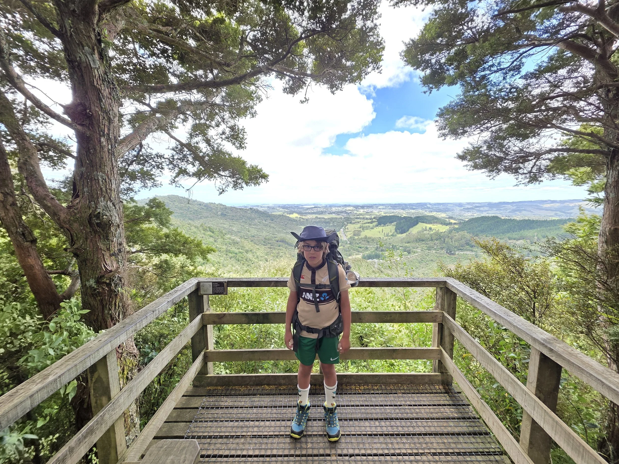
Look out over Walkworth Valley
Back to civilization - Day 1
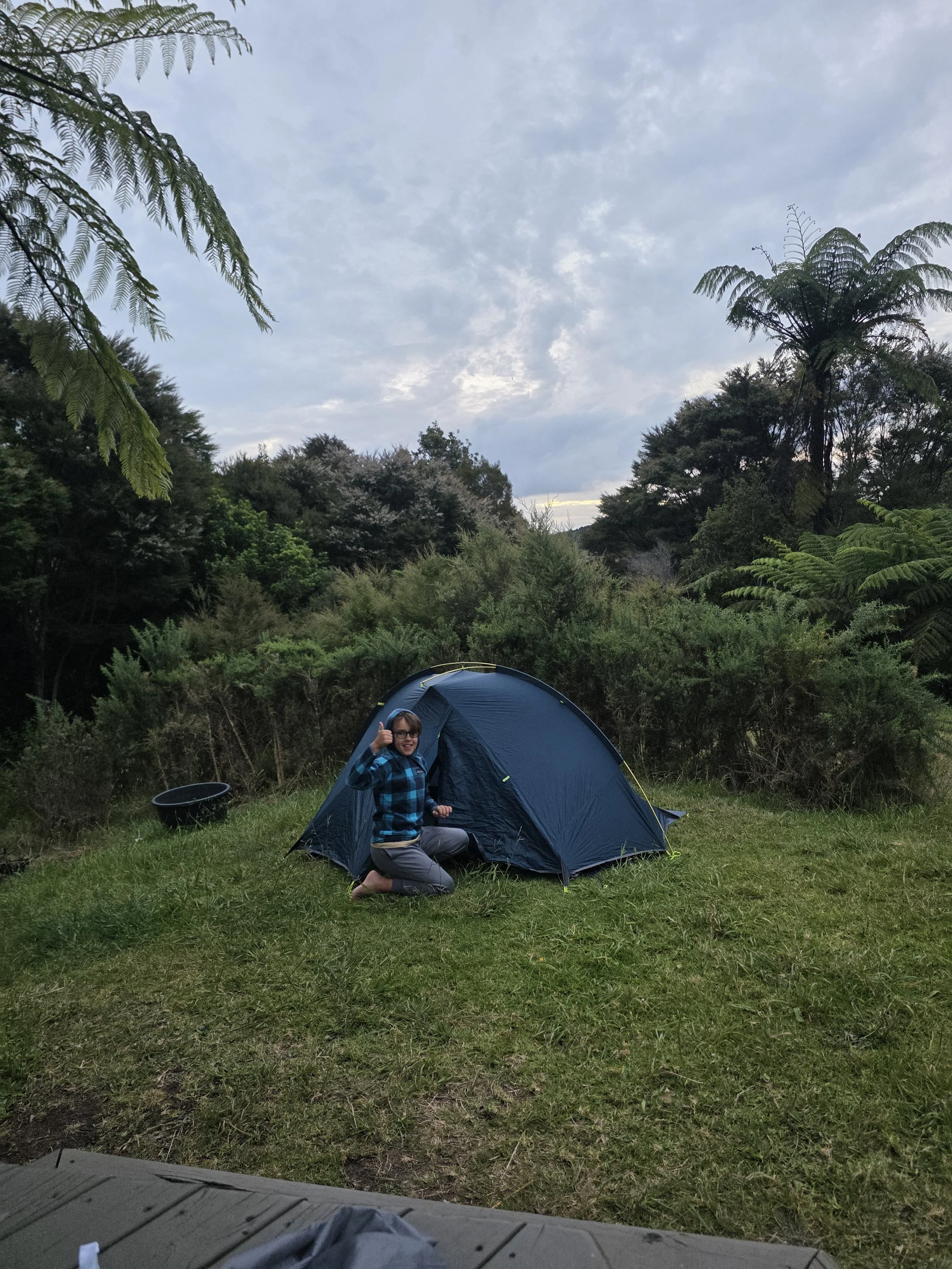
Night 1 Camp
Day Two – Hard Yards
Overnight my phone didn’t charge, leaving me with about 10% battery. Keen to avoid a repeat of the communication issues on the previous trip I fired off a quick message to Jo before turning my phone off to save the last of the battery.
Breakfast was freeze-dried scrambled eggs, which actually went down well. Then we packed up and got started on what we new was going to be another big day. From the campsite we made our way along Goven Wilson Road then onto Matakana Valley Road for a short stretch before heading back into the bush. From the road the trail dropped sharply into bush, plunging down into a valley before climbing straight back out again. The easy part of the day was clearly over.
We then climbed back up onto the ridgeline of Omaha Forest working towards the weather station at the peak. The climb up was long and steady, and we reached the station right on time for lunch. We enjoyed our salami and cheese sandwiches, eaten sitting on concrete beside the massive structure wondering exactly what the huge radar above us was doing to us.
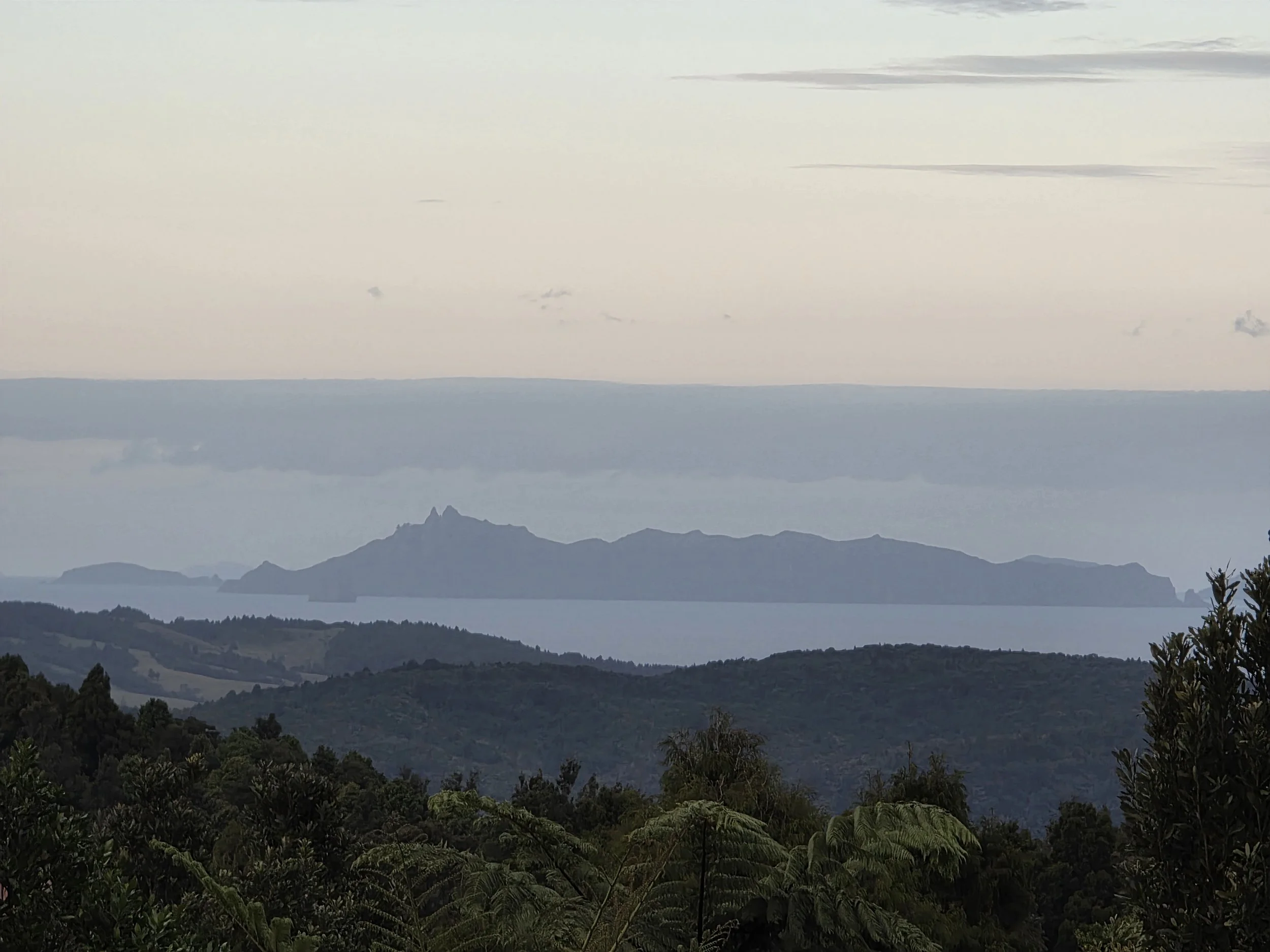
We assumed that was the high point for the day. It wasn’t, or if it was it was one of many. Another climb followed, this time to a summit with a helipad, before the trail continued along rolling ridgelines through forestry land. Eventually we emerged into farmland with sweeping views over Pakiri, the Hen and Chicken Islands, and Mangawhai in the distance.
There was a sense of hope and accomplishment being about to see our destination down below us. It wasn’t to last as our run of great weather finally turned. We could see the rain coming and got our jackets on before it hit.
We were near the campsite I’d hoped to reach the previous night (dreams are free). By now Robbie was absolutely spent having walked for around 7hrs already, but we needed to get to Pakiri Holiday Park so I could charge my phone and get back in touch with Jo. We decided to push on.
The final descent was slow and miserable: long wet grass, rain-soaked legs, slippery footing. It took close to an hour to cover about 2 km. When we finally reached Pakiri township, Robbie was done. I was carrying both packs.
A local woman stopped and offered a lift along the final 3km of gravel road to the holiday park. That lift probably saved the evening. Robbie jumped in and I walked the last stretch alone and met him there. We set up, charged devices, and collapsed. Around 9½ hours of walking that day, roughly 14 km, and almost all of it hard.
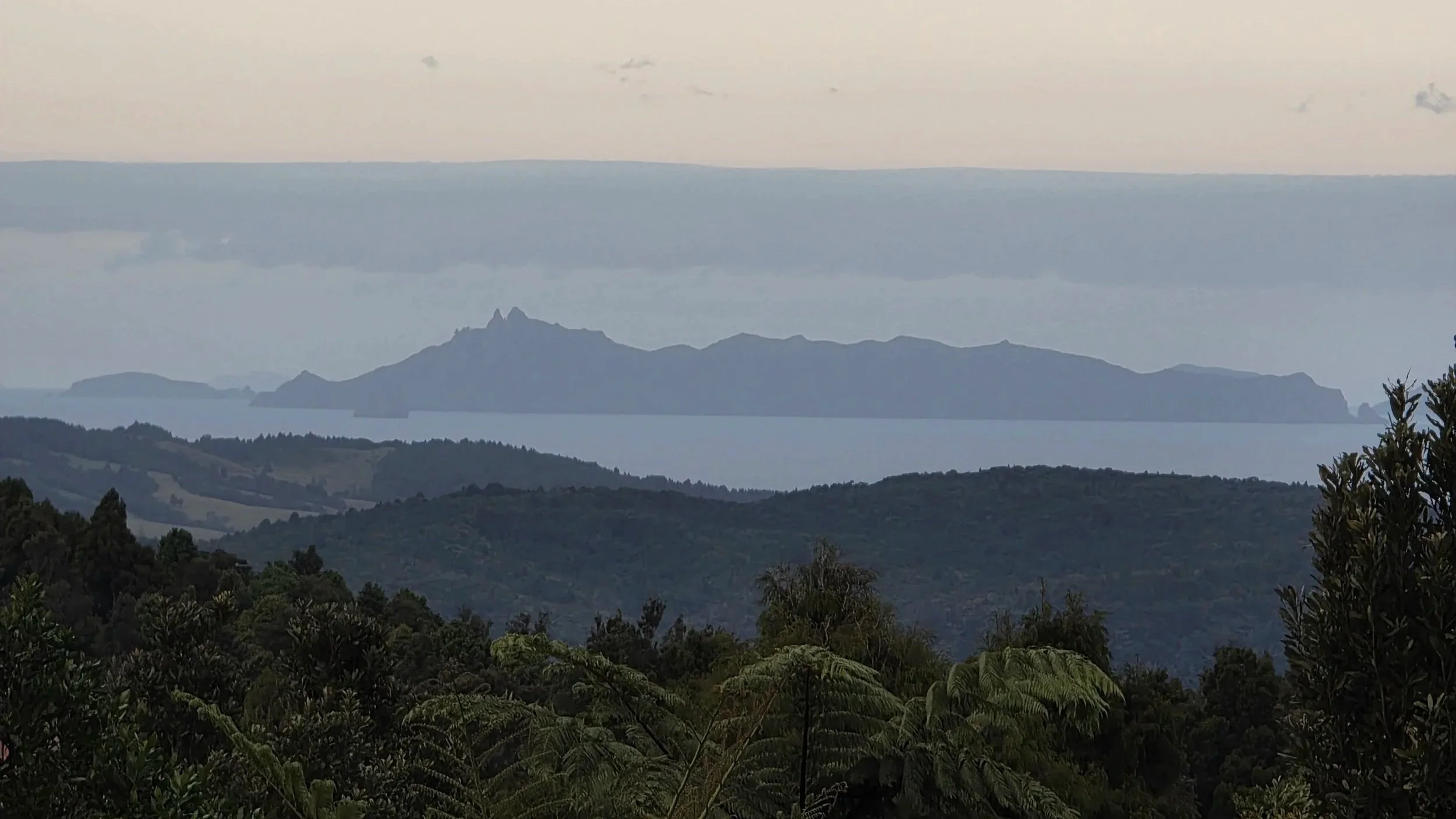
View from the top - Day 2 - Looking over Pakiri to the Hen
Day Three – Solo to Te Arai
That night I finally reconnected with Jo, who had been understandably anxious. Robbie had had enough so she’d pick him up the next morning on her way north, and I’d finish the last day solo.
After a slow breakfast, a walk on the beach, and a game of giant outdoor chess (which I finally managed to win), Jo arrived. Robbie headed north with her, and I stripped my pack down to a day load and set off on the final stretch.
The final leg was a 13 km beach walk from Pakiri to Te Arai. Windy, but straightforward. Steady plodding, plenty of time to think, and a different pace after the previous two days.
At Forestry Beach, instead of heading inland as the trail does, I decided to try rounding Te Arai Point. With an outgoing tide, it looked feasible. Most of it was fine, scrambling along rock shelves, but about three-quarters of the way around I hit a section that couldn’t be passed safely without climbing high above the jaggered rocks below.
The choice was turn back or get wet.
I tied a rope to my pack, placed it to a ledge, climbed down, and jumped into the water. It turned out to be about chest deep so I could walk instead of swim and quickly made it across to the next dry ledge. I used the rope to haul the pack over the gap and continued on. A small moment of problem-solving to finish things off.
I reached the Te Arai Point car park to find Mum waiting to give me a lift back to a shower and a hot meal.
Wrap-Up
Three big days. Kayaking, ridge walking, steep climbs, tired legs, wet grass, and a bit of improvisation. Walking Te Araroa with the kids added a completely different layer to the experience—slower, harder, but far more memorable. December done.
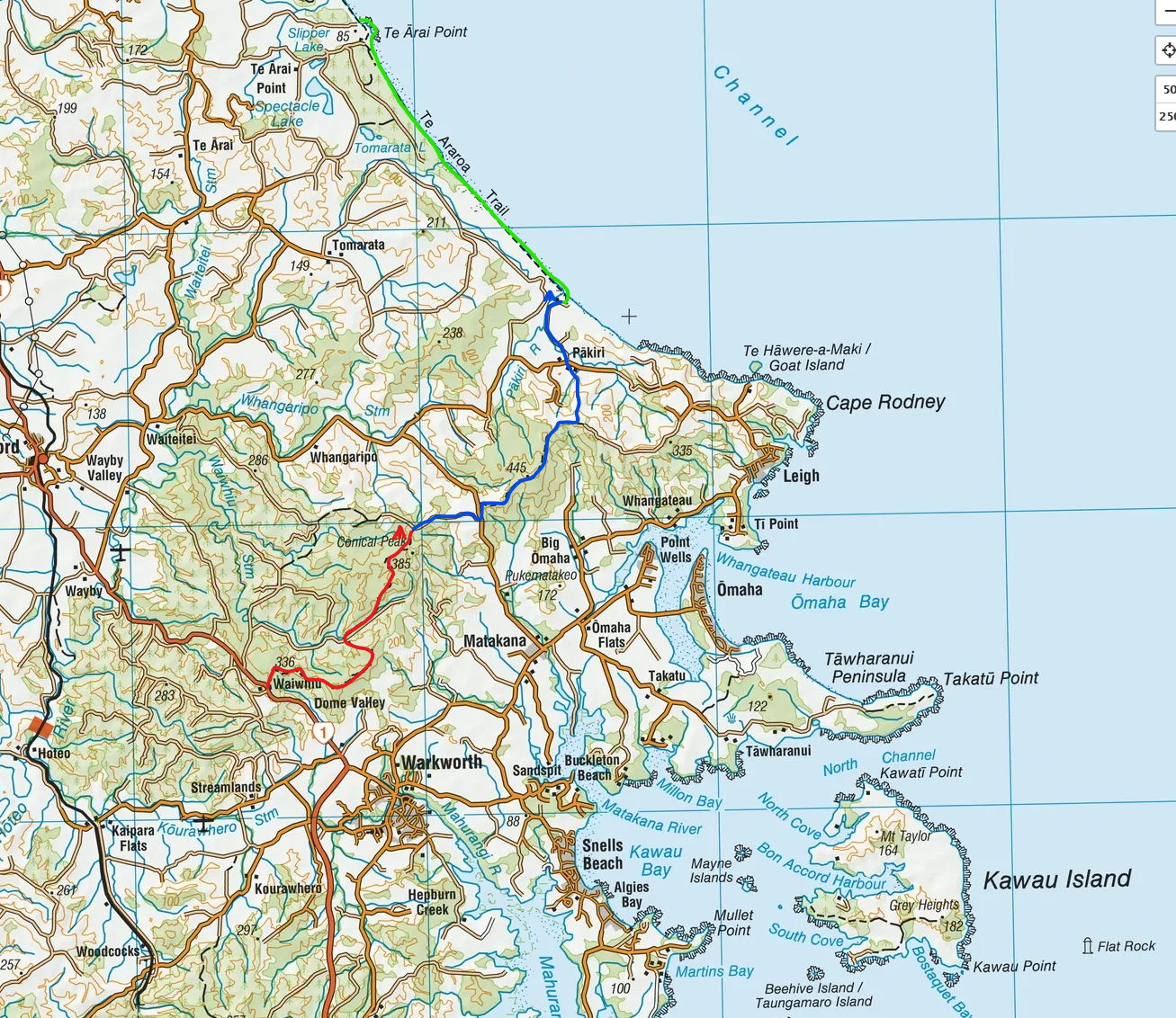
Route Map
(Day 1 Red, Day 2 Blue, Day 3 Green)