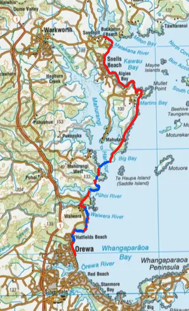
Adventure 4 - Coast “Walk”
to Sandspit
Working the Coast to trouble.
November only gave me one day. Work was busy, life was full, and the calendar didn’t care that it was “adventure time”. So I took the Friday, dropped the kids at school, and set off with a simple plan: get to Sandspit by catching the bus to Orewa, then work my way along the coast. We were at Sandspit for the weekend so Jo was bring the kids up after school and I would meet them there.
By late morning I stepped off the bus in Orewa with a small dry bag: water, some snacks, mask, snorkel, fins. I expected to be swimming at least some of the coast. I just didn’t know how much.
After fuelling up with some Sushi in Orewa, I headed north along the beach until the sand ran out and the rocks began. The tide was higher than expected. Halfway around the first headland, the coast closed in completely. No line through without getting wet.
So I stopped pretending it was a walk. Clothes off. Gear into the dry bag. The bag went into the water first, then I followed. A steady swim carried me around the point and onto Hatfields Beach.
That set the rhythm for the day. Walk. Change. Swim. Change again.
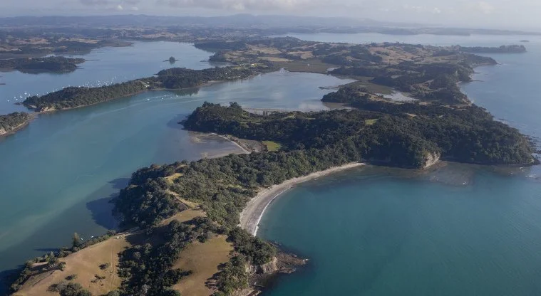
From Hatfields, I moved through a series of small, tucked-away beaches south of Waiwera — places that feel like private beachs with access only at low tide or via private properties from above. The coastline here was rough, waves breaking over rock shelves, but between swims the walking was surprisingly clean. Barefoot on smooth stone, moving slowly, paying attention.
I passed another walker attempting the same section without swim gear. He was getting smashed by the swell. We didn’t get a chance to talk as I was in the water when I passed him. I saw he turned back not long after from the other end of the beach.
Once I reached Waiwera, the boots went back on for good — at least for a while. I walked through town, refueled on water and a bickie then crossed the old SH1 bridge, and climbed into Wenderholm Regional Park. Quiet bush tracks, cool shade, the kind of place that feels far removed from the morning’s swims.
I eventually emerged into the main public area of the Wenderholm park and made my way to the northern end of the spit where the Pohoi river meets the sea. By now the tide had turned. I changed again, slipped into the water at the Pūhoi River mouth, and let the outgoing tide pull me out around the point before swimming into the southern end of Mahurangi Regional Park.
I came ashore at Te Muri Beach, somewhere I’d camped years ago as a teenager. I had the whole bay to myself, and knowing that I needed to cross another stream at the other end of the bay decided not to change back into my clothing and walked the beach in my speedo’s.
From there it was across the stream and up and over the hill, and down toward the Sullivans Bay campground on the Mahurangi Harbour.
This was the final water crossing. The Boss. A 1.5km swim across the the Mahurangi Harbour. By this stage I was well behind schedule, about 3hrs behind when I expected to be doing the crossing. I had missed the tide, but the conditions were good and I was feeling strong so decided I was good to go. I decided that I would stop and call Jo from the northern side to let her know I was running late. So fins and mask on I set off.
The swim itself was uneventful. Calm water. Good visibility. No stress. I crossed in about 25min. The problem appeared when I reached the far side.
My dry bag had opened. I looked inside to see everything bobbing around in a pool of water. My phone, already with a cracked screen, was dead. No photos. No messages. No way to tell anyone where I was or that I was running late. I wasn’t hurt. I wasn’t lost. I just didn’t have anyway to communicate anymore (other than my EPIRB which I wasn’t about to activate for a broken phone). To add to the problem I was in one of the most remote parts of Auckland, the nearest settlement was Martins Bay about 7km to the north.
So I walked.
Up onto the ridge, along it for a couple of kilometres, then down onto the eastern beaches of the peninsula. For two hours I didn’t see another person. Just empty sand, headlands, and the steady realisation that I still had a long way to go and that I was going to be in a lot of trouble when I got there.
At Martins Bay I finally saw people. I used the phone at the campground to try and contact someone. The only number I could remember (Jo’s parents) didn’t answer.
So I kept moving.
Over another ridge, through Scandrett Regional Park (for the record my third for the day ), along the coast to Algies Bay, There I spotted a familiar boat lying on the sand that I hope might mean a familiar face nearby. I new Terry’s (from UWR) boat instantly and started asking local houses if they new where Terry lived. Unfortunately this lead didn’t pay off and it wasn’t long before I was walking again.
By the time I reached Sandspit it was after 8:30 pm. Thirty-six kilometres on foot. Around an 1.5hrs of swimming. I was exhausted, very late, and in an appropriate amount of trouble with Jo.
The phone was replaced a few days later. No photos survived other than the one I had posted to my mates on Messenger. No proof it happened, beyond sore legs and a story that’s hard to explain quickly. But that’s fine. Some adventures don’t give you much to show for them. They just take a day, quietly, and give it back as something you’ll remember for a long time.
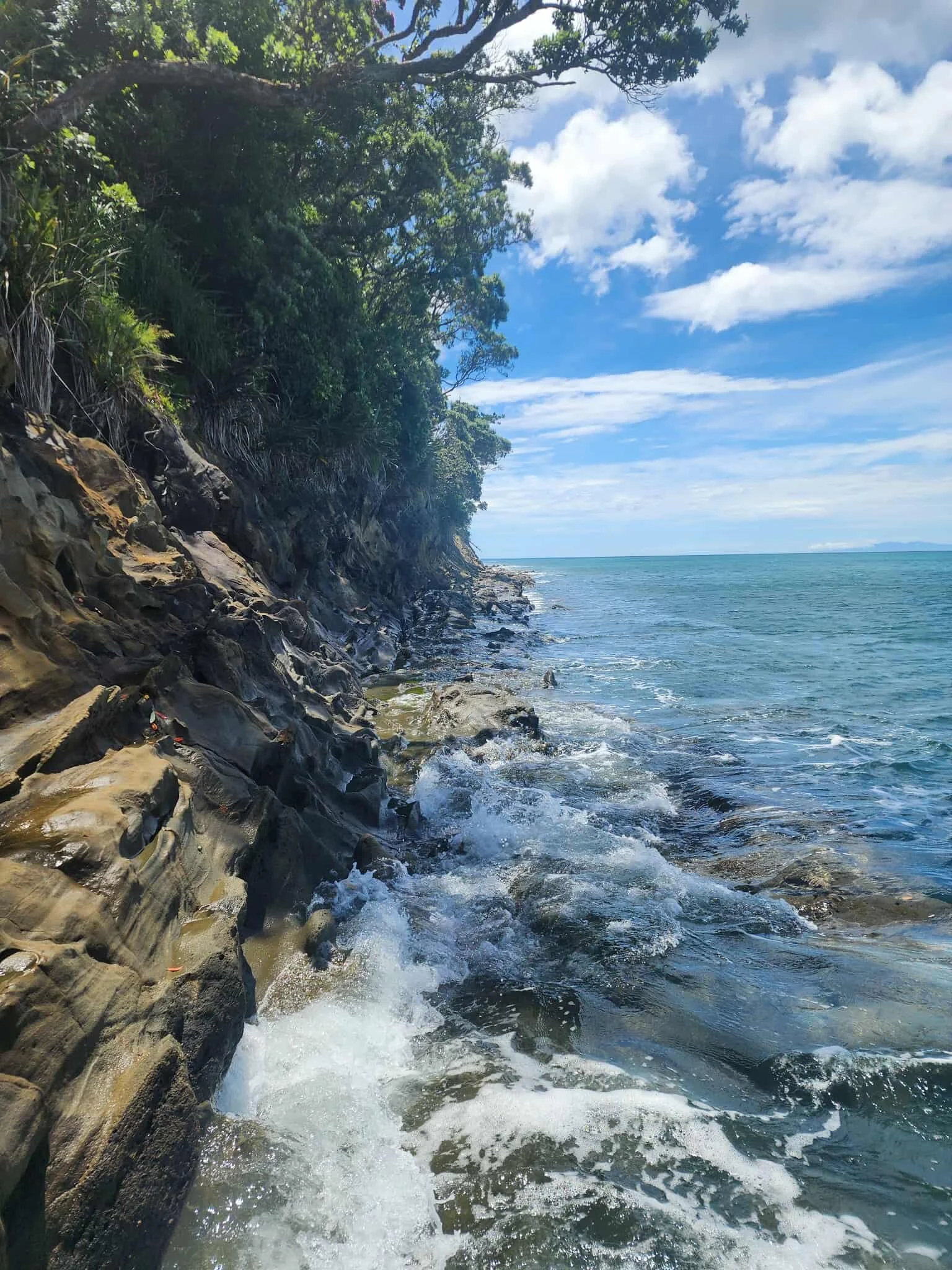
A “Walkable” section of coast south of Waiwera.